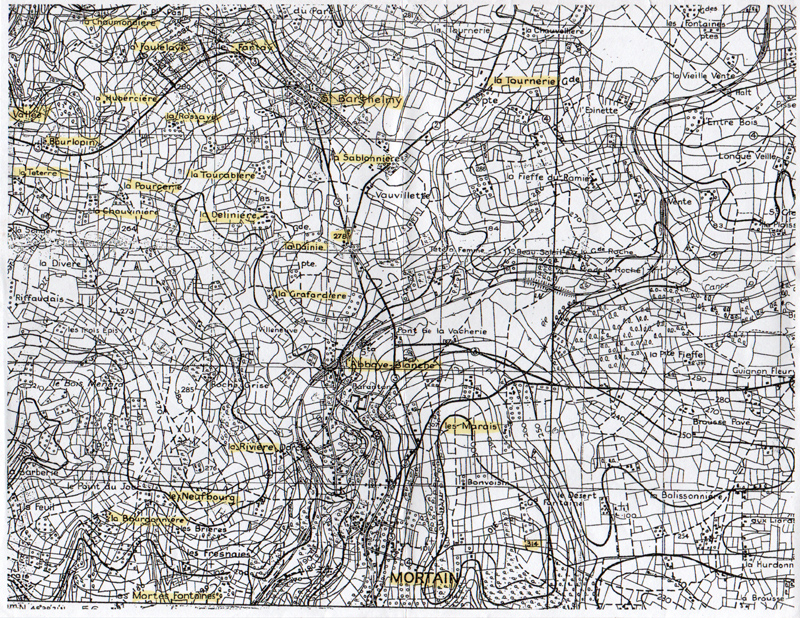

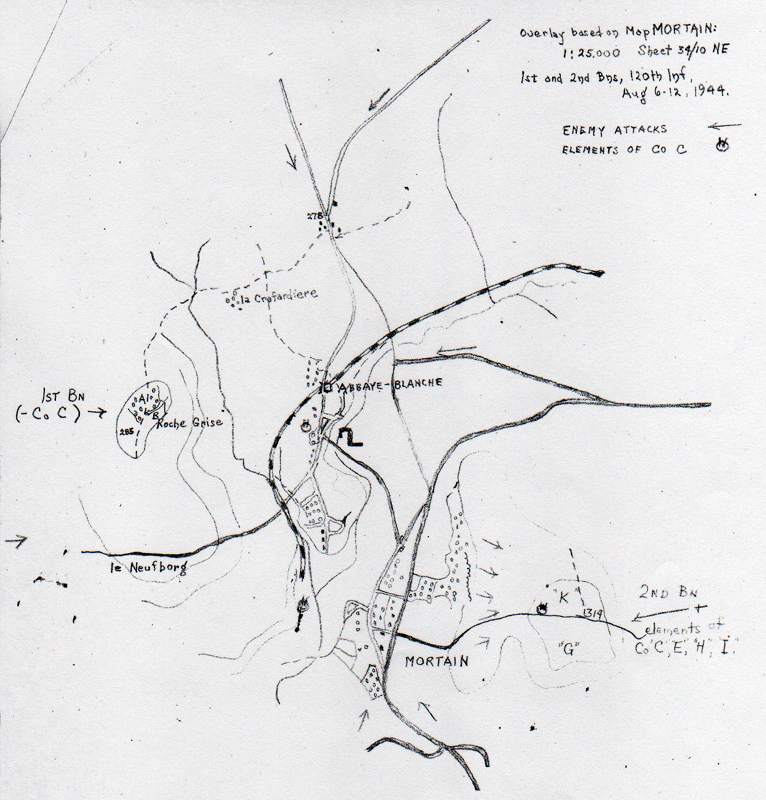
Mortain
 Sign on the road leading up to Hill 314, Petite
Chapelle is the small chapel near the 30th ID Memorial.
Sign on the road leading up to Hill 314, Petite
Chapelle is the small chapel near the 30th ID Memorial.
 Photo of Hill 314 from the South-West, the
building on the hill is the Petite Chapelle.
Photo of Hill 314 from the South-West, the
building on the hill is the Petite Chapelle.
 Some information on a sign on Hill 314.
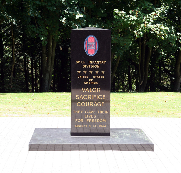 The memorial on the top of Hill 314.
 A hole on Hill 314 which pretty much looks like a
square foxhole, on this side of the hill there were many crater-like holes as
well. This is in Co. G's area.
A hole on Hill 314 which pretty much looks like a
square foxhole, on this side of the hill there were many crater-like holes as
well. This is in Co. G's area.
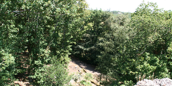 Positions of E Company on the South-East of the
hill.
Positions of E Company on the South-East of the
hill.
 View at Mortain taken from the Northwest side of
Hill 314. The houses on the left are Mortain, and left is Abbaye Blanche. The
hill in the background is Hill 285.
View at Mortain taken from the Northwest side of
Hill 314. The houses on the left are Mortain, and left is Abbaye Blanche. The
hill in the background is Hill 285.
 One of the main reasons for taking Hill 314 was
of course the sight. Here a photo to give you an idea how far you can look. The
hill like object on the photo is Mont St. Michel, a chapel build on a hill more
than 40 km to the west! The hill maybe not very high, but the sight is
incredible.
One of the main reasons for taking Hill 314 was
of course the sight. Here a photo to give you an idea how far you can look. The
hill like object on the photo is Mont St. Michel, a chapel build on a hill more
than 40 km to the west! The hill maybe not very high, but the sight is
incredible.
 This photo is taken south of Mortain near the site of the 120th's Co. F
roadblock. Read about this position told by George E. Neidhardt of Co.
F...CLICK to READ
This photo is taken south of Mortain near the site of the 120th's Co. F
roadblock. Read about this position told by George E. Neidhardt of Co.
F...CLICK to READ
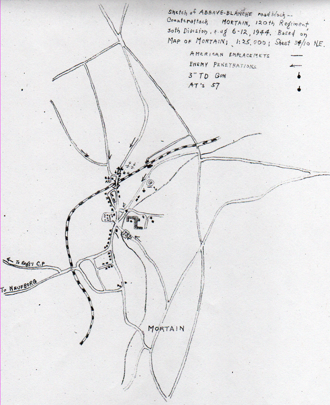
l'Abbaye Blanche:
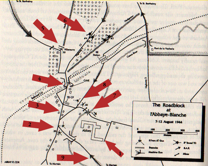 Using a map drawn by Jay Karamales match the numbered arrows with the
corresponding numbered photos below. Present photos taken by Tim Ypelaar
of Kerkrade, Holland.
Using a map drawn by Jay Karamales match the numbered arrows with the
corresponding numbered photos below. Present photos taken by Tim Ypelaar
of Kerkrade, Holland.
No. 1
 The abbey itself.
No. 2
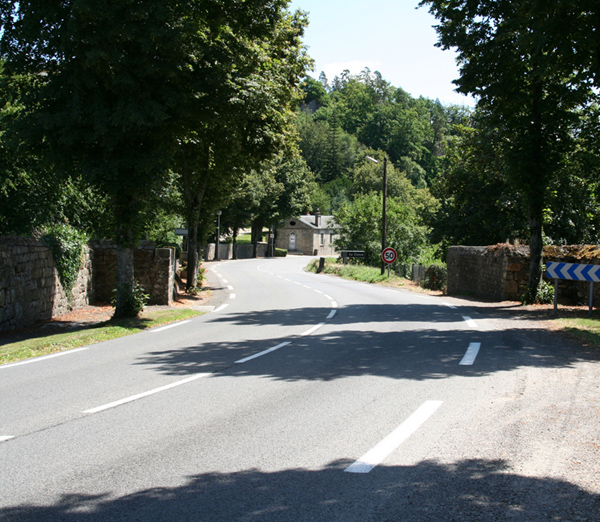 Bridge on road
to Mortain:
This bridge was a roadblock, mined on the other side, and covered by a .30 cal
Machine Gun and a 57mm AT gun. If you follow the road over the bridge you'll get
into the center of Mortain.
Bridge on road
to Mortain:
This bridge was a roadblock, mined on the other side, and covered by a .30 cal
Machine Gun and a 57mm AT gun. If you follow the road over the bridge you'll get
into the center of Mortain.
 Probable
position of the .30 and 57mm AT gun.
Probable
position of the .30 and 57mm AT gun.
 Road leading to
St. Barthelmy north and Mortain South:
the AT gun could have been on this
road as well. The road leads to the next couple of photo's, on the other side is
the bridge on the photo of the bridge leading to Mortain. (
No. 2 )
Road leading to
St. Barthelmy north and Mortain South:
the AT gun could have been on this
road as well. The road leads to the next couple of photo's, on the other side is
the bridge on the photo of the bridge leading to Mortain. (
No. 2 )
No. 3
 Small square
besides the road leading to St. Barthelmy (2006):
This is sort of a small square (it is actually a triangle), along the road
leading to the bridge at arrow 4 and going to St. Barthelmy. It has been made
like the next photo has been made in 1944. The TD CP can be seen in the
distance.
Small square
besides the road leading to St. Barthelmy (2006):
This is sort of a small square (it is actually a triangle), along the road
leading to the bridge at arrow 4 and going to St. Barthelmy. It has been made
like the next photo has been made in 1944. The TD CP can be seen in the
distance.
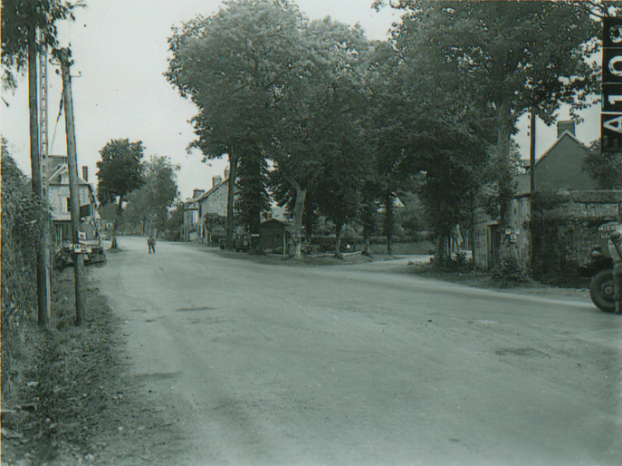 Small
square besides the road leading to St. Barthelmy (1944):
Same photo angle as above.
Small
square besides the road leading to St. Barthelmy (1944):
Same photo angle as above.
 Small
square besides road leading to Mortain (2006):
Same square only from the other side, this road leads to the roadblock at arrow
1.
Small
square besides road leading to Mortain (2006):
Same square only from the other side, this road leads to the roadblock at arrow
1.
 Small
square besides road leading to Mortain (1944):
Same photo angle as above.
Small
square besides road leading to Mortain (1944):
Same photo angle as above.
 TD CP:
Tank Destroyer CP, not sure if this was the house standing in 1944, this could
be a new house. But the CP stood on this spot. Please note TD CP is marked on
map between Nos. 3 & 4.
TD CP:
Tank Destroyer CP, not sure if this was the house standing in 1944, this could
be a new house. But the CP stood on this spot. Please note TD CP is marked on
map between Nos. 3 & 4.
No. 4
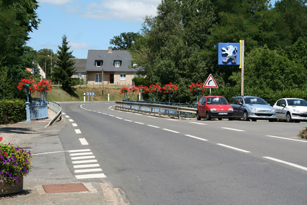 Bridge on road to
St. Barthelmy: Bridge leading to St. Barthelmy, was covered by a .50 cal
machine gun. Off course all roadblocks were also defended by infantry and
bazooka teams.
Bridge on road to
St. Barthelmy: Bridge leading to St. Barthelmy, was covered by a .50 cal
machine gun. Off course all roadblocks were also defended by infantry and
bazooka teams.
No. 5
 Roadblock position
on road to St. Barthelmy: iIt was also covered by a .50 machine gun. The road
leading to the left was mined, and the one to the right blocked by a barricade.
Roadblock position
on road to St. Barthelmy: iIt was also covered by a .50 machine gun. The road
leading to the left was mined, and the one to the right blocked by a barricade.
No. 6
 Positions 3" guns:
This was probably the position of the 2 3"guns covering the road to St.
Barthelmy. They would have been pointed at the camera, the road leads in to the
village of Abbaye Blanche.
Positions 3" guns:
This was probably the position of the 2 3"guns covering the road to St.
Barthelmy. They would have been pointed at the camera, the road leads in to the
village of Abbaye Blanche.
No. 7
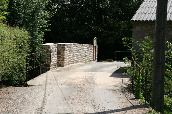 Roadblock
position on small bridge to the abbey:
There were mines laid in
front of this bridge, and defended by a BAR position as well. It leads to the
abbey.
Roadblock
position on small bridge to the abbey:
There were mines laid in
front of this bridge, and defended by a BAR position as well. It leads to the
abbey.
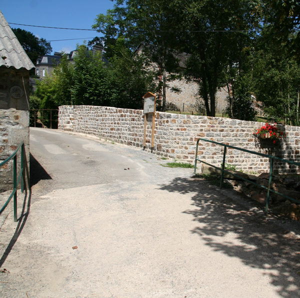 BAR position on other
side of the bridge:
Here the BAR positions must
have been, there are actually 2 bridges I guess the BAR position would have
been after the first bridge.
BAR position on other
side of the bridge:
Here the BAR positions must
have been, there are actually 2 bridges I guess the BAR position would have
been after the first bridge.
No. 8
 Position 3" towed
TD gun:
Probable position of the 3" gun covering the road to the railroad station.
Position 3" towed
TD gun:
Probable position of the 3" gun covering the road to the railroad station.
 Position .30 MG:
Probable position of the .30 cal machine gun covering the road to the railroad
station.
Position .30 MG:
Probable position of the .30 cal machine gun covering the road to the railroad
station.
No. 9
 Mortain sign:
The road leading into Mortain.
Mortain sign:
The road leading into Mortain.
Another series of Now and Then Mortain photos from John Croxton, Mortain
Click here to open the Microsoft Word document
John also owns a Bed and Breakfast in Mortain for those who wish to visit Mortain: